Survey Equipment – The Essentials
Essential Survey Equipment
Any experienced surveyor knows that there’s a plethora of survey equipment required to complete the wide range of complex surveying tasks.
A surveyor needs to be competent in the laws and regulations around the placement of building assets, but they also need to be competent in operating a broad range of electrical and mechanical hardware to get the job done right.
Different surveying disciplines require different methods of data capture, interpretation, and reporting. Mining surveyors may use equipment used in civil, hydrographic, and aerial surveying. Civil construction surveyors may also use this equipment. A surveyor working in the inner city may use a different set of tools entirely.
Let’s break down the typical essentials for one of the most common types of Surveying, Cadastral/Land Surveying.


Electrical Equipment
Measurement hardware is perhaps the most important survey equipment out there. Without it, a surveyor can’t produce the measurements required for a job site.
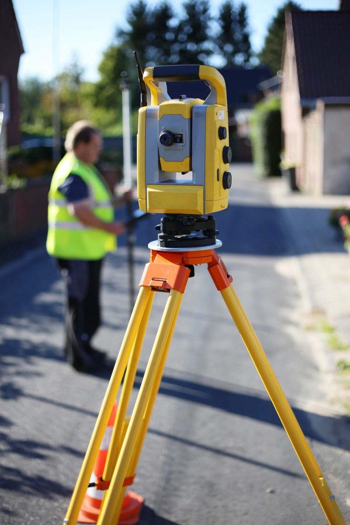
Total Station
A total station is an incredibly accurate modern electronic measuring device. It uses geometry and distance measurements in horizontal and vertical planes to determine accurate measurements between known points.
This vital piece of equipment is the go-to measuring device for most surveyors. It requires a direct line of sight between the instrument and the target (often a prism) to provide accurate distance measurements.
GNSS Base and/or Rover
The GNSS (Global Navigation Satellite System) or ‘GPS’ allows a surveyor to make measurements based on satellite location, rather than an optical line of sight to the target like the total station.
The GPS is a versatile piece of equipment as it allows the surveyor free movement behind line-of-sight obstructions, which would usually render the total station at a disadvantage. This versatility comes at a cost of accuracy and measurement repeatability.
Since a satellite signal does not penetrate tree canopies effectively, this signal may become easily disrupted when anything obstructs a clear view of the sky. The accuracy of most GPS systems will be ~10mm on the horizontal plane, and ~25mm on the vertical, whereas a Total Station can be as low as 1mm.
Data Collector and Software
Raw data coming from the GPS or Total Station means nothing if it cannot be interpreted in an effective way. A data collector is a piece of hardware, such as a small ruggedised tablet, which allows data coming from the instrument to be displayed to the surveyor. This data allows the surveyor to complete the tasks at hand. Data collectors often communicate via bluetooth or radio to their respective instruments.
Surveying Tools
When carrying out surveying jobs in the field, the surveyor not only needs to have electrical equipment on him/her, but also a collection of tools and consumables. Let’s break down what a survey equipment is needed on hand when out in the field.
Surveying Pegs/Stakes
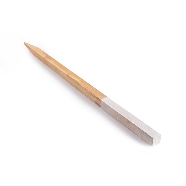
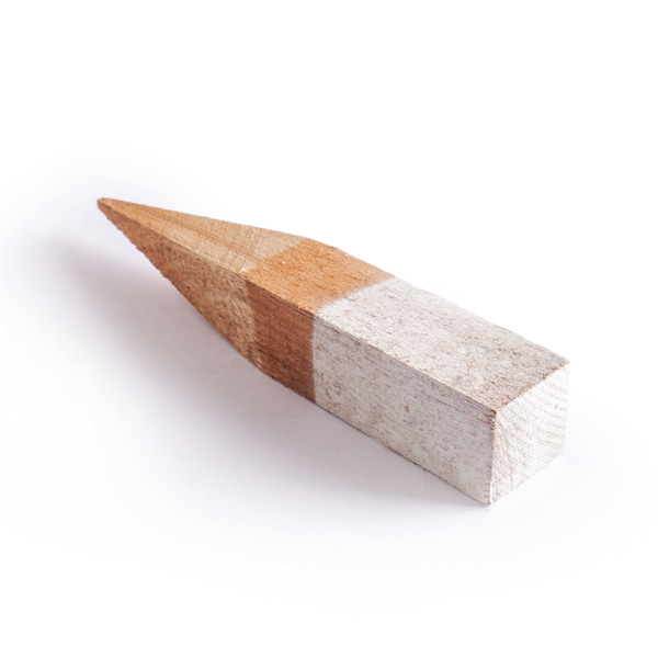
A boundary peg is used to effectively mark the location of assets (building corners, boundary points, etc). A surveying boundary peg comes in various sizes with the most common being a square top of ~50mm with a length of 350mm.
A hardwood timber peg may be used for soft ground and marked on top with a nail or pin. An aluminium tag will also be used to denote the description of the asset. For harder ground, a polycap peg may also be used, which consists of a steel spike driven into the ground by an impact driving tool to avoid damage to the top of the spike, followed by a brightly coloured cap for easy location of the survey peg.
A survey stake is used to mark the location of this asset as the boundary mark is often under or at ground level. This marker survey peg is usually ~900 mm long. The ID number of the boundary or asset below is written on the peg with a permanent marker or paint marker to ensure the description does not fade with exposure to the elements.
These pegs are carried around site in a survey stake/peg bag, which can carry almost all of the consumables needed for a surveyor.
Hammers
Pegs don’t go in the ground without a hammer! A sturdy yet lightweight club hammer does the trick for most applications. Fibreglass or timber are preferred handle options for their light weight and durability.


Nails
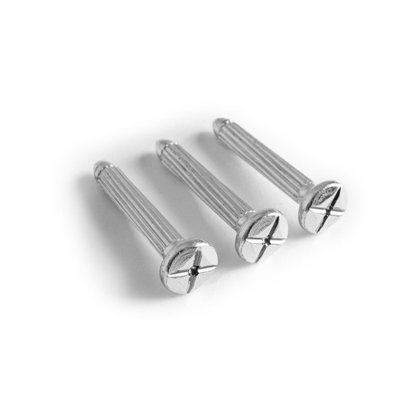
A surveyor needs to use a range of nails depending on the application. A specialised survey nail is a thicker nail with a cross on top. It is used when a semi-permanent mark is required and is hammered into asphalt or another slightly softer surface. Clout nails are used to signify the centre point of a mark on a timber boundary peg.
Clout nails are hammered into the peg through a small aluminium plate. This then allows the surveyor to mark the asset description with a number or letter punch.
Concrete nails are, you guessed it, for the hard concrete surfaces of building floors or support structures. They often have a washer which allows them to stably enter the concrete without movement and allow for easy visual identification. They are commonly known as “Micky Pins”.
Deck spikes are solid spikes of 150mm to 200mm for harder surfaces where marks are needed, but no cross on the top of the nail is required.
Flagging Tape
A surveyor needs to hammer pegs and stakes into the ground, but also needs to show others where these assets are.
A long stream of flagging tape tied to the top of the peg notifies people of the type of service the peg indicates. Colours of flagging tape are coded to particular services, and it is generally accepted on most job sites that pink flagging will indicate a lot boundary peg is nearby; red may indicate a sewer underfoot; and green indicates the position a wall may need to be built.
Noting where a peg may be located in terms of X and Y coordinates is important, but what about Z, or height?
For example, stormwater drainage needs to be laid to a specific level, otherwise the water will not flow in the correct direction. A peg is placed where a manhole or drainage pit needs to be, and another piece of flagging or electrical tape is then wrapped around the peg at the correct level the drainage needs to be laid at.
If the drainage level is underground, a distance down to this level is marked on the peg. Red tape at this mark indicates to cut about 500mm below the mark. Yellow indicates a 1m cut, and Blue indicates the finish level.
Marking Products
Asset locations that can’t be marked with pegs are often marked with a spray and mark aerosol paint.
For example, an intersection upgrade may have a new kerb to be installed where some asphalt already exists. The surveyor will then usually mark this new kerb location with a nail, then use marking paint to highlight its location.
Different colours of marking paint also indicate different assets. New kerbs may be marked with blue, and new line marking will be marked with a white paint.
Field Books
Field books are essential pieces of survey equipment, as they provide vital records of measurements carried out on site.
The most common field books in Surveying are the Chartwell field books. These have a different type of book depending on the requirements of the job. A level traverse book will have columns drawn for the Rise/Fall/RL for a traverse, this is referred back to for point information and proof of accuracy.
A general notebook is also required for location sketches, computations and important job notes.
Safety Equipment
Almost all job sites now require the use of basic PPE equipment.
This includes safety hard hats, safety glasses, steel capped boots, and hearing/breathing protection.
Sunscreen for the harsh sun is critical, and continuous days in the sun with no sun protection greatly increases the risk of fatal skin cancers.


