March 2025 Newsletter

Site Safety & Equipment
Introducing some new products to our range of Worksite Safety!
These solutions can be seamlessly integrated with our existing star pickets and survey stakes, offering versatile combinations to meet your specific site requirements.
NEW Barrier Fence Mesh 50m Roll – $49.50 Inc. GST
Use with our star pickets or stakes to create temporary fencing.
NEW Triangle Post Cap Yellow (pack of 100) – $49.50 Inc. GST
Use with our star pickets to increase visibility and avoid injury. Also available in packs of 20.
NEW Bunting Flags ORANGE 100m Roll – $55.00 Inc. GST
Use to cordon off hazards or to prevent unauthorised access. Other colours and sizes available.
NEW Cable Ties Black 300mm x 4.8mm (pack of 100) – $6.60 Inc. GST
Use with our barrier mesh or flag bunting to secure them to posts or pickets.
To see more products in the Site Safety range, click here.

Top Industry News In The Past Month
Revolver Resources has made its Dianne Copper Mine Project more efficient with Mangoesmapping’s mapping and surveying services. Pat Williams, Managing Director of Revolver Resources, is passionate about demonstrating that mining can be done not only commercially, but also ethically and responsibly.
Click here to read more.ACA Encouraging Women To Pursue Construction Careers
The Australian Constructors Association – in partnership with the New South Wales government – has launched the “It’s Possible” campaign to encourage mid-career women to consider a career change into construction.
Click here to read more.
Mapping Water: Can You Really Do It?
Mapping areas with water through photogrammetry can be a challenge. Sun reflections and homogeneity between images can really make the process difficult. Resulting DSMs/DTMs can often be noisy, while orthomosaics may present colour issues.
Click here to read more.
Veris Announces Acquisition of Spatial Vision
Veris has revealed it’s agreement to acquire 100% of Spatial Vision, in a cash and scrip deal valued at up to $3 million. Michael Shirley, MD and CEO of Veris states, “We are thrilled to welcome the Spatial Vision team in to the Veris family.”
Click here to read more.
Melissa Harris To Head Geoscience Australia
Melissa Harris has been appointed the new CEO of Geoscience Australia, replacing the current CEO, Dr James Johnson, who last year announced his plans to retire after eight years in the role.
Click here to read more.
Mapping To Predict Lightning And Fires
Edith Cowan University’s collaborative lightning strike study with NASA has just completed its first round of aerial data collection. The effort has used infrared cameras to analyse the terrain in WA’s south-east region to select areas for a lighting mapping network.
Click here to read more.
Australian researchers are designing a global real-time monitoring system using GIS and AI technologies to help save the world’s coral reefs from further decline, primarily due to bleaching caused by global warming.
Click here to read more.

Upcoming Industry Events
WA Major Projects Conference – March 19 & 20
The two-day conference returns with a focus on the infrastructure to support Western Australia’s growing population and will provide a high-level platform to discuss key projects and topics centred around WA’s infrastructure pipeline.
For more information, click here.
11th Annual Aus Gov Data Summit – April 1-3
The Aus Gov Data Summit is dedicated to advancing the government’s agenda of leveraging data as a national strategic asset. This premier event aims to empower Australian public service data leaders to elevate their missions, increase efficiency, and deliver exceptional public services.
For more information, click here.
Geospatial Leadership Training & Land Administration Global Forum – April 1-4
The program will include a Certified Leadership Training Course, which will equip executives and leaders with the knowledge, skills and insights needed to leverage geospatial technologies effectively and drive innovation within their organisations.
For more information, click here.
2025 Queensland Business Academy – April 3 & 4
The Business Academy is a unique opportunity for business leaders from Surveying firms to come together, learn, and review their businesses with a view to improve profitability and achieving other measures of success.
For more information, click here.
Locate25 Conference & FIG Working Week – April 6-10
For 2025, the annual Locate conference will be held in conjunction with the FIG Working Week 2025 conference, taking place alongside each other in Brisbane. Both events will offer unparalleled access to the international surveying and geospatial community, providing a platform to exchange experiences and stay at the forefront of developments across various aspects of surveying and geospatial practices.
For more information, click here.
SA Major Projects Conference – April 8 & 9
The two-day conference will bring together over 20 senior-level professionals to discuss major infrastructure projects in store for the state, connecting industry stakeholders and providing a platform for valuable networking opportunities.
For more information, click here.
ISASA Monthly Board Meeting – April 17
Join the The Institution of Surveyors Australia – South Australia Division Inc, for our monthly board meeting.
For more information, click here.

What is the Forest Stewardship Council?
The Forest Stewardship Council (FSC) is referred to as the gold standard of sustainable forestry, and we are extremely proud to be a certified FSC member.
Being a part of the FSC ecosystem ensures that you’re supporting responsible forestry management with its wide range of benefits, not just for the forests themselves, but for those whom depend on it’s maintenance for their own survival.
Check out the FSC Factsheet under “Resources” to read more about Elevate Survey Supplies’ FSC involvement and the causes you support by purchasing our 100% FSC Certified timber products.
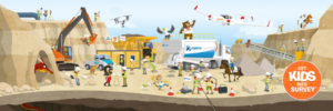
Inspire the Next Generation of Surveyors with Get Kids Into Surveying!
This dynamic project is dedicated to igniting a passion for geospatial science in young minds.
Through engaging educational resources and exciting initiatives, “Get Kids into Surveying” is shaping the future of the surveying profession.
Making a Difference:
- Empowering Educators: Providing teachers with the tools and resources to bring surveying to life in the classroom.
- Building Partnerships: Collaborating with surveying associations to create impactful outreach programs.
- Nurturing Talent: Offering global scholarship schemes to support aspiring surveyors.
Explore a world of interactive learning materials, hands-on activities, and career exploration resources designed to inspire the next generation of geospatial professionals.
Ready to make a difference? Join the movement and become an ambassador today!